Drone Surveying: Hazardous Waste Cleanup on an Industrial Site
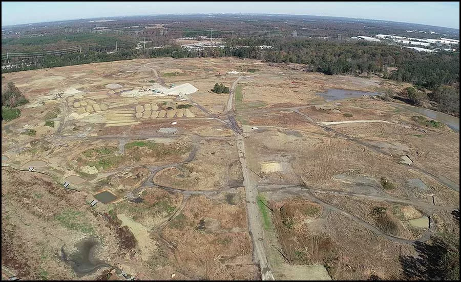
This aerial view from our drone shows a portion of the 415-acre industrial site.
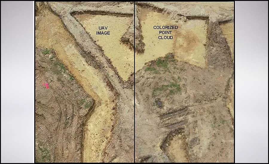
The left image shows a photo capture from the unmanned aerial vehicle (UAV) during data collection. The right image shows the post-processed colorization of the resulting 3D point cloud created from the UAV imagery.
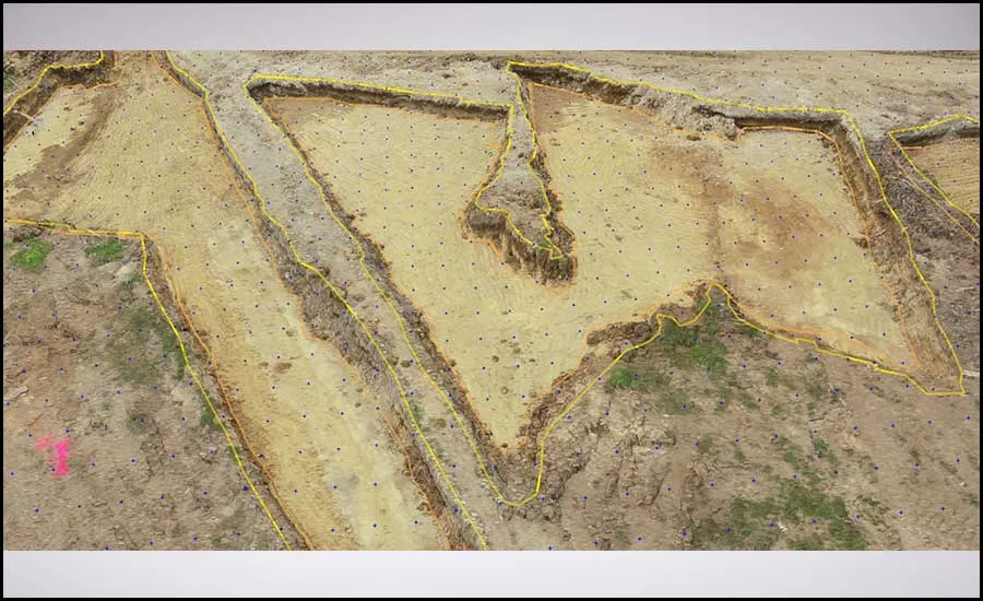
Pix4DSurvey allows the user to draft in a colorized 3D environment. Orange and yellow linework represents top and bottom topography break lines, blue grid of dots represents ground spot data. All three entities are used to create a highly accurate surface model of the site.
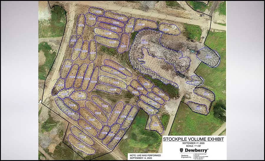
Georeferenced orthomosaic showing remediated soil stockpiles. Using the surface model created by Pix4DSurvey and the drone imagery, we were able to calculate the volumes of the removed soil from the remediation sites and provide the client with exact volumes of replacement soil that would need to be brought on site.
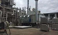
Drone usage in the architecture, engineering, and construction (AEC) industry has grown steadily over the last decade, and the list of applications in projects continues to expand. Drone usage ranges from damage assessments to stormwater inspections and can often be used as a safe and time saving alternative to traditional surveying methods. When combined with the latest data visualization and point cloud technology, drone surveys can deliver data-rich information to clients. Dewberry recently used its drone capabilities to assist with hazardous waste cleanup on a site in Gainesville, Virginia.
Pinpointing Contaminated Soils
The demolition and remediation work of this 415-acre industrial site included excavation and disposal of contaminated soils on 26 locations throughout the site. Dewberry’s Gainesville engineering department was asked to provide persistent on-site monitoring and reporting. For example, engineers were tasked with verifying the soil removal areas were excavated to required sizes and depths. Then, staff calculated the volume of excavated soil to confirm the contaminated soil had been removed. This presented a perfect scenario to use a survey drone for site data acquisition.
Traditional survey methods would have included a two- or three-man survey crew to set control, enter each excavated site, define top and bottom edges, and locate ground shots both in the excavated area as well as along the top perimeter of the dig site. After checking Federal Aviation Administration (FAA) airspace requirements and local drone regulations, we employed a DJI Phantom 4 RTK drone and a one-man crew to collect the data needed in a fraction of the time, all while being safely positioned outside of the excavated areas on stable ground.
Approximately 12 separate flights were conducted from September through November 2020 to support the monitoring and reporting needs. The drone data produced from these flights, which included VRS calibrated orthomosaics, dense point clouds, and digital surface models, were examined and utilized to generate reports used by our client to determine if the soil remediation areas were excavated to the specified requirements.
The most innovative aspect of this project was the incorporation of the Pix4DSurvey program in our post processing workflow. Pix4DSurvey allowed Dewberry’s team to draft line work in a 3D colorized point cloud environment. The point colors were extracted from imagery captured during the UAV flight. Without this software, transferring a desired point cloud into a deliverable software, such as an AutoCAD file, would have been challenging.
Stockpile Volume Reporting
In addition to surveying the excavated areas, drone flights captured stockpile areas of soil removed from the contaminated areas. This allowed the engineering team to quantify the volume prior to hauling the material to the appropriate waste facility. In turn, this provided the client and contractor with up-to-date volume data so they could make informed decisions about managing the earthworks on the site. Ultimately, this led to reduced cost and time savings for the overall project.
A Desirable Alternative to Traditional Survey Methods
With the use of one of our survey drones, we provided the client with data rich reports they used to confirm whether soil remediation requirements on the project were met or exceeded. Using a UAV also provided the client and Dewberry’s team with a safe, quick, and efficient alternative to traditional survey methods to gather the required data while staying under budget.
Looking for a reprint of this article?
From high-res PDFs to custom plaques, order your copy today!